• A Cruiser’s Guide to Annapolis, Maryland

    Annapolis, Maryland is an iconic sailing town, not only on the east coast but around the sailing world. The number of boats that pepper the shoreline of this little coastal town is astonishing. We have had the pleasure to visit this awesome town a number of times, one of which was when we began this journey of buying a sailboat when we went to the annual Annapolis Sailboat show. 

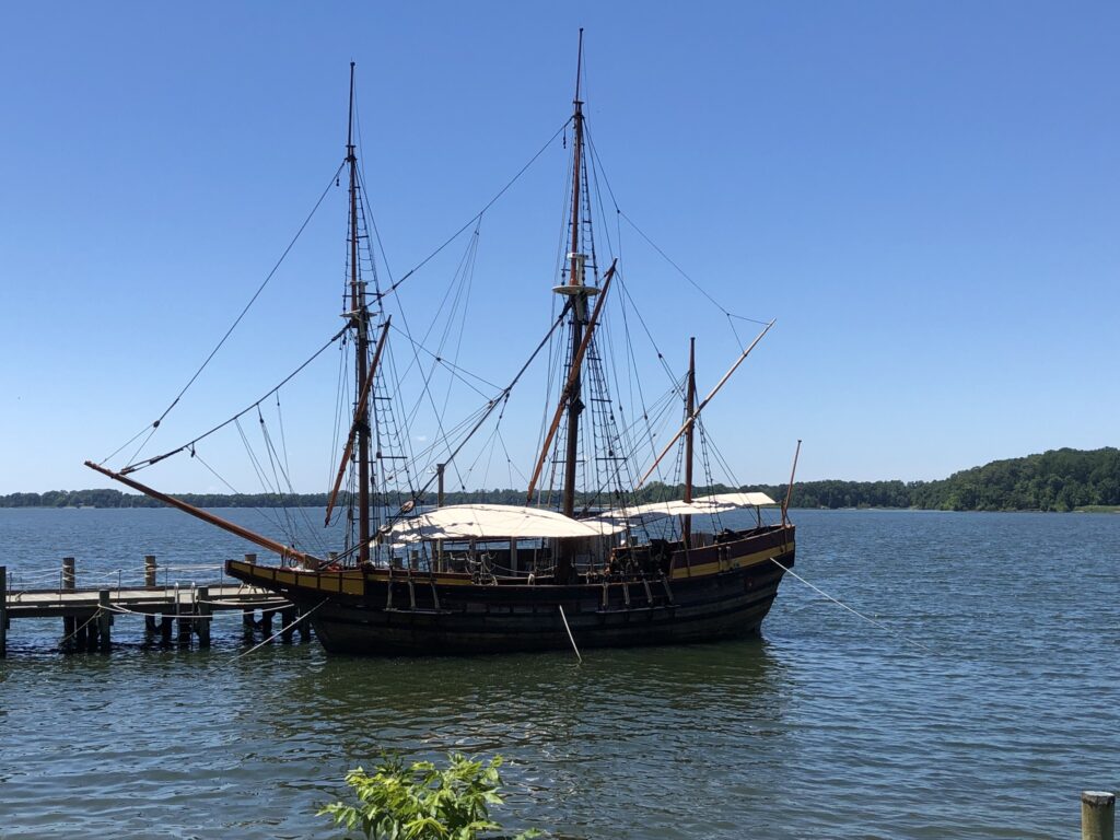
    We love Annapolis! It may be one of our favorite places we visited during our entire time sailing the east coast. Everything from the variety of boats, yachts, marinas, the vast history of the area, the Naval Academy, crusty seafood restaurants. The list goes on and on. There are so many reasons to visit Annapolis but visiting on a sailboat takes it to another level. 

    We have sailed into Annapolis in both July and Mid-October so we have been able to see the town at different times of the year. It always has something great to offer and never disappoints.

    Boating Season

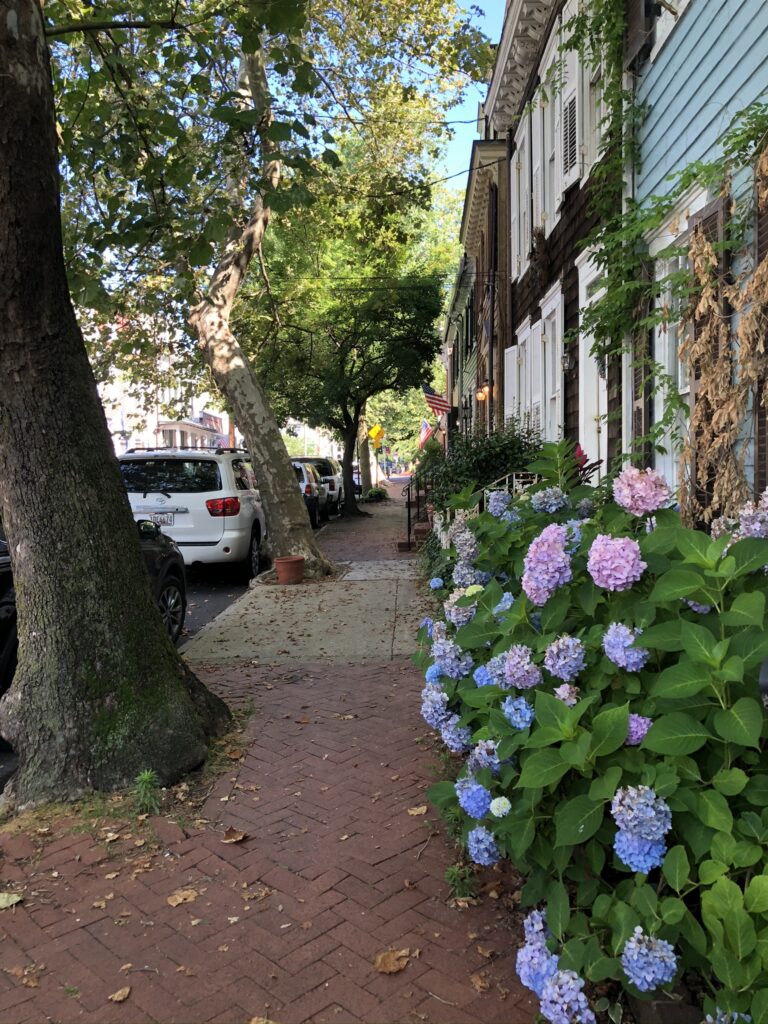
    One of the many beautiful streets of downtown Annapolis

    Annapolis boating season runs from roughly mid-March to mid-November unless you love full foulies and frigid temperatures. Although freezing, the winter has the strongest winds with noreasters commonplace. Spring and fall is the premier time to be sailing around Annapolis as well as the entire Chesapeake Bay. The weather during these seasons is much milder than both summer and winter and offers much more consistent steady breezes for more predictable sailing conditions and weather. 

    Come summertime, the boating season is full-on and the weather is hot and humid and the breeze can be light out of the south to southwest. With the hot and humid weather comes thunderstorms that can be severe at times with winds up to 60 knots or more.

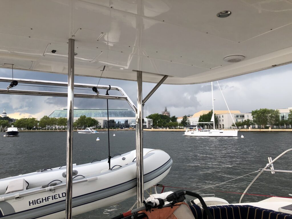
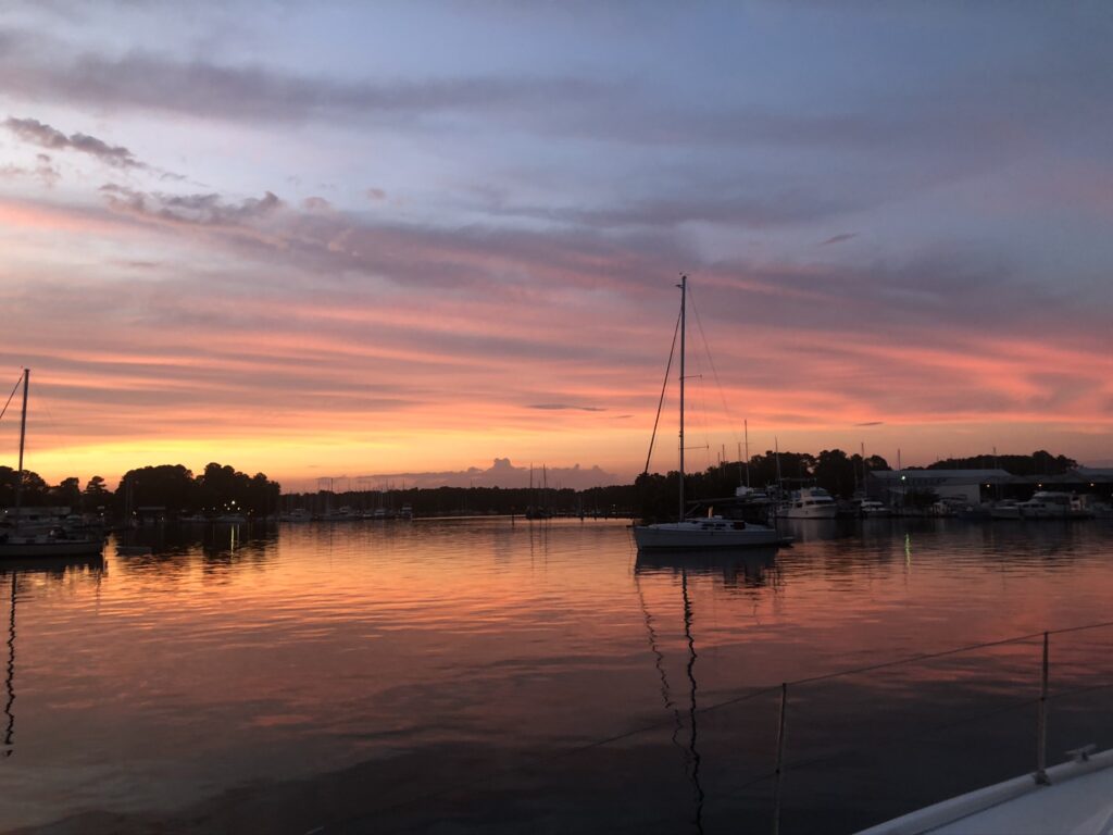
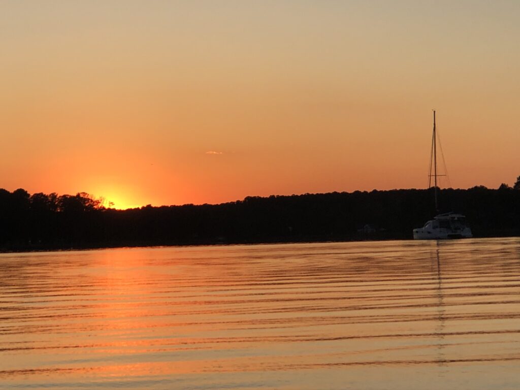
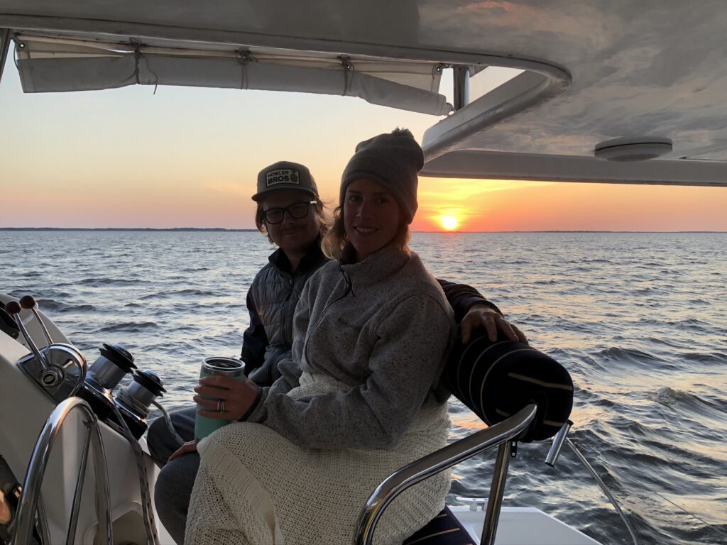
    Approaching thunderstorm on Annapolis Harbor

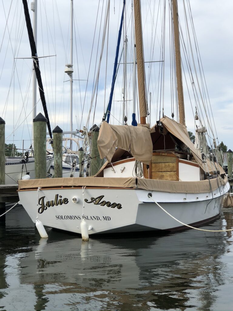
    Seasonally, this town has a few different faces. During winter, the town is reduced down to the local residents and watermen with few visiting boaters, but come summertime, this town is bustling with every type of watercraft. Sailboats, schooners, wood boats, powerboats, trawlers, sailing schools, and everything in between. If it floats, it can be found in Annapolis on any summer day.

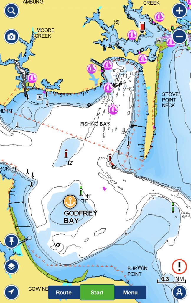
    Approach and Anchorage

    Access to the Harbor and creeks of the Annapolis area is as easy as it gets. If you’re traveling from the south the lighted radio towers on Greenbury Point can be visible from a way out marking the north shore of the Severn River. Traveling from the north, the Chesapeake Bay Bridge will be the first thing you see if you’re coming from the upper bay or the Baltimore area. Once you pass under the bridge you should be able to see those same lighted radio towers to starboard. 

    Once the towers are located, you’ll want to locate the two buoys marking the inlet to the Annapolis harbor channel. If you are coming from the south you will want to keep the Green #1 AH to port until you round into the harbor channel as it is marking a large shoal that extends from the shore. When coming from the north, look for the Hacket Point shoal Bouy after you have passed under the bridge. If you keep the HP shoal buoy to starboard you will stay well clear of the shoaling near shore. After you pass the shoaling buoy you should start to really see the Lighted Radio towers on Greenbury Point as well as a few NOAA weather buoys. Keep these to starboard as you begin to round the point into the Annapolis Harbor Channel.

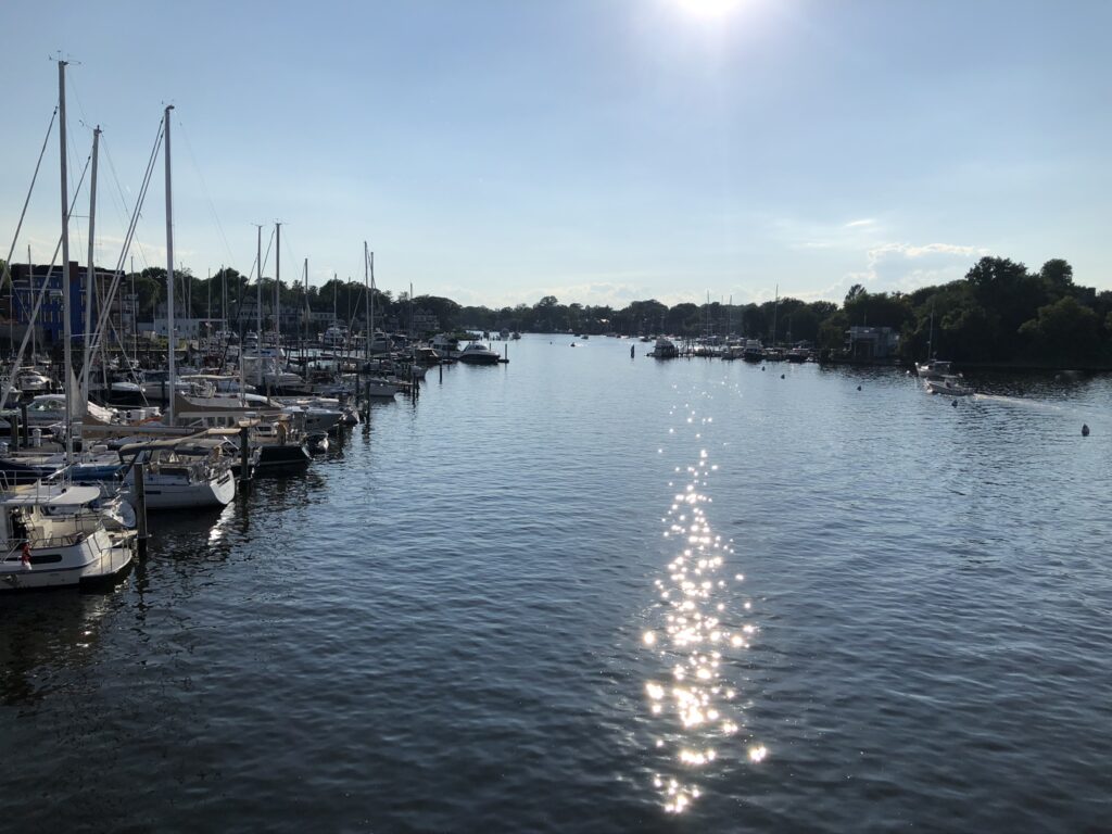
    View looking up Spa Creek from the Spa Creek Drawbridge

    Once in the channel, you will have a wide variety of anchorage options. The north shore of the Severn does not offer that much in terms of anchorages. The majority of anchorages that will allow access to the heart of Annapolis are going to be in Back Creek, Spa Creek and the main Annapolis Harbor.

    Back Creek will be the first creek that will appear to port on the south side of the Severn River. Here you have numerous options when it comes to marinas but the anchorages can be a bit tight with docks lining both shores extending well into the creek. The city of Annapolis manages a mooring field towards the end of the creek which would serve as a great spot in the spring and fall when the temps are a little cooler, but it can be downright stifling in the summer. This could also serve well if the weather is up as it is extremely protected with land all around.

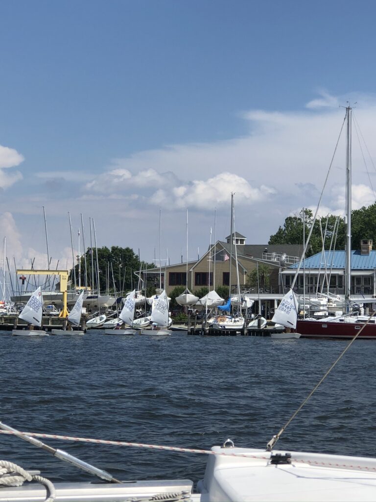
    Sailing school in Annapolis Harbor

    Continuing up the Severn River your next option will be the main harbor of Annapolis and Spa Creek. This is the heart of all the action, whether you choose the municipal mooring field in front of the Naval Academy, a slip in Ego Alley or you head up the creek a bit further you will be in the middle of everything Annapolis. In our opinion, the best option is just grabbing a mooring from the municipal field in front of the Naval Academy. These are first-come, first-serve, so just cruise in, grab a ball and hail the Harbor Master on channel 16. These should be available on all but the most crowded of weekends, i.e., the annual boat show. 

    Other options up Spa Creek are another municipal mooring field on the other side of the Spa Creek drawbridge that can accommodate boats up to 35 feet. Up the creek, there are two more municipal mooring fields that can accommodate vessels between 45 and 55 feet. Like the mooring field up Back Creek, these could get hot during the summer, but offer good protection in weather. The anchorages past the drawbridge are certainly more spread than the anchorages up Back creek but still packed with boats especially during the summer months.

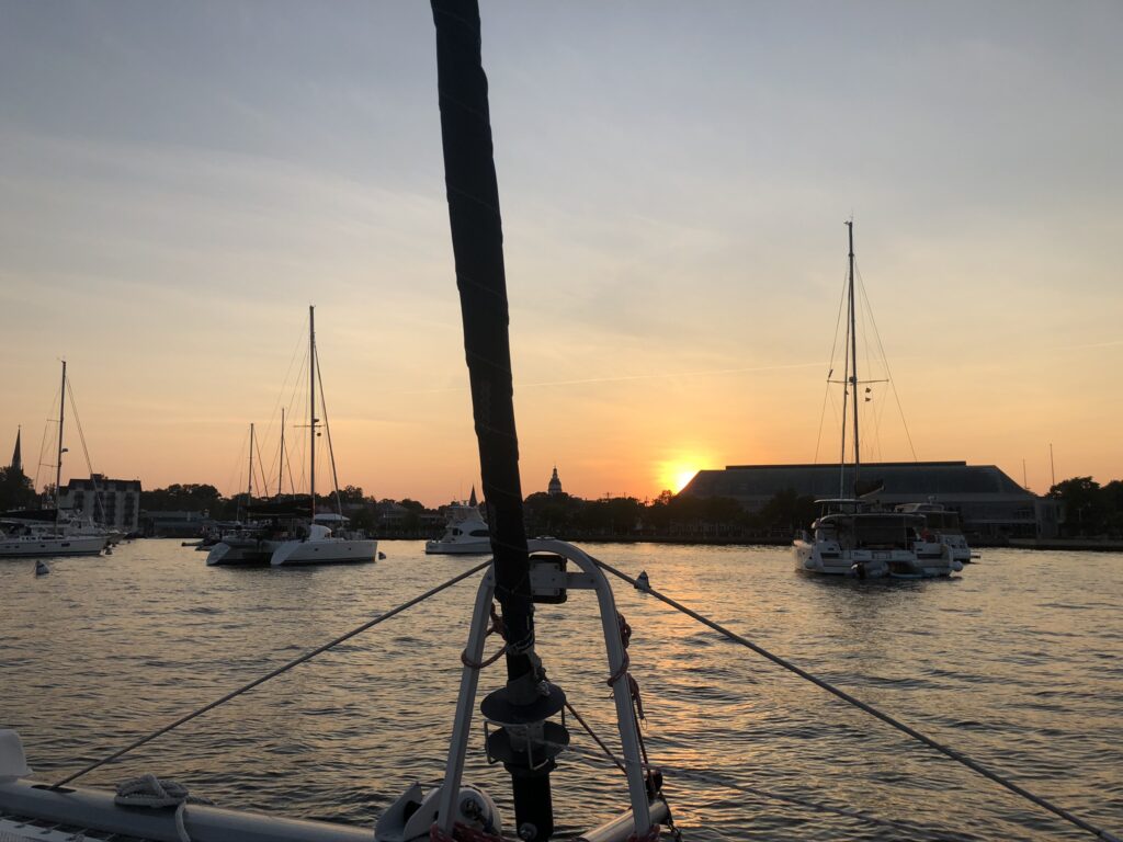
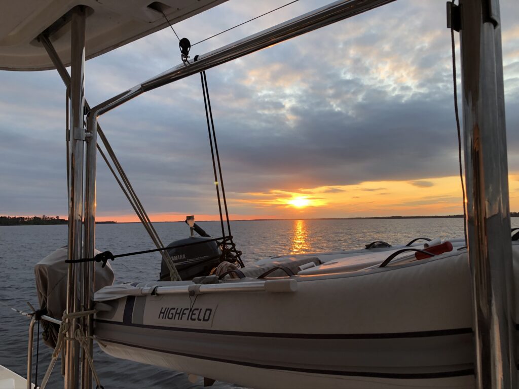
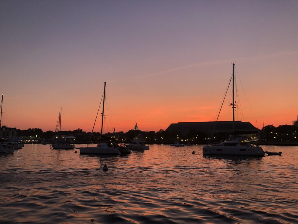
    Sunset over Annapolis Harbor from the municipal mooring field

    On calm days, especially in the summer, boats do anchor out towards the entrance of spa creek and Annapolis Harbor, but be aware there are some deep spots right at the entrance of the harbor so you may have to anchor a ways from land and you will need to be wary of fetch. 

    Further up the Severn River especially past the Baltimore Annapolis Blvd. bridge, you can find a number of quiet anchorages with plenty of room but requires a pretty substantial dinghy to get back to the heart of Annapolis. 

    HIghlights and Attractions

    Annapolis is an awesome walking town. With multiple dinghy docks in town, you can dinghy your way up to either Back or Spa Creek park and hit the streets with your feet. We stayed at the main mooring field when we came to town and just parked the dinghy at either ego alley or right next to the Naval academy and hit the town.

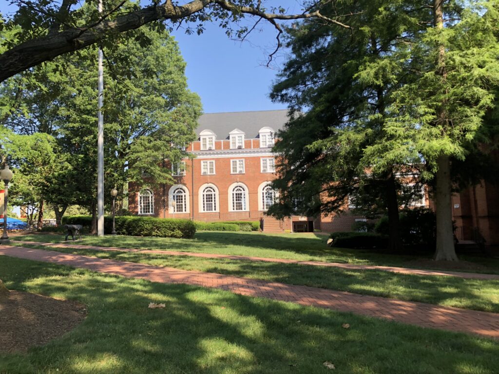
    The beautiful grounds of St. Johns College

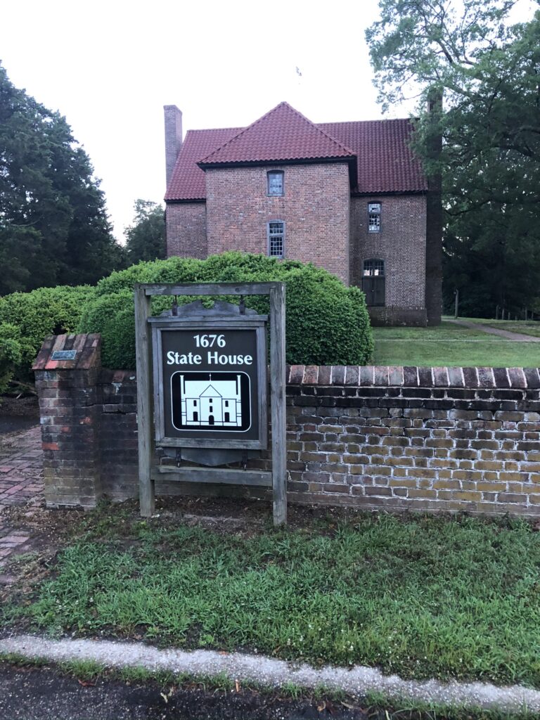
    Besides the obvious tour of the Naval academy and all the other activities available there, Annapolis has a lot to see and explore. Just simply walking up the streets from downtown, you can admire the old, historical townhomes, dotted along mainstreet. One of our favorite walks is just docking the dinghy and heading up the hill to St. John’s College. The grounds of the school are immaculate and it is a great place to take the doggies and let them run around. On the way up the hill or back down, be sure to stop at the Maryland statehouse, which is the oldest U.S. state capitol in continuous legislative use, dating back to 1772.

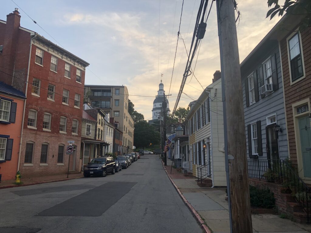
    Looking up East Street toward The Maryland State House

    There are all the tourist stores and restaurants along Main street just up from ego alley, but if you want to get the real flavor of Annapolis you will be remiss if you don’t make your way over to Davis’ pub in Eastport. This place is the epitome of local Annapolis and local sailors of Annapolis. We visited in July of 2020 and they had blocked an entire block off to serve people safely and we met so many awesome people that lived in town there or other fellow cruisers, all while just waiting for a table. The food is just as awesome as the atmosphere, highlighted by the crab cakes and the peel-and-eat shrimp.

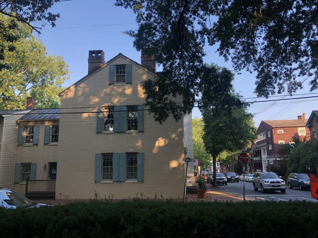
    One of the many gorgeous houses around the Annapolis are

    Eastport as a whole is a quieter neighborhood with everything from waterfront restaurants to hole-in-the-wall breweries to high-end dining. Taking a stroll over the Spa Creek Drawbridge is well worth the time and effort. 

    Sailing around Annapolis and visiting the town should be on the very short list of any cruiser traveling north or south in the Chesapeake Bay. We have always had a wonderful time when we visit and it truly is one of our favorite towns on the eastern seaboard.  

  • Solomons Island, MD by Boat

    Visiting Solomons Island (“Solomons” for short), MD in any vehicle is sure to be a special experience but visiting by boat certainly adds to the allure of this charming town, situated on the shores of the Patuxent River and the Chesapeake Bay. Equally located between Norfolk and the Chesapeake and Delaware (C&D) canal, it makes for a great stop for any boaters traveling up or down the Chesapeake Bay. Additionally, it is really the only reasonable port and anchorage close to the main channel of the Chesapeake Bay, between Annapolis and the Potomac, as most other options are a long way up long, winding creeks.

    Solomons didn’t used to be such a hot spot for water sports or visitors. It does however have a rich history on the water from local fisherman harvesting seafood to shipbuilding the local waterman’s vessels for fishing. Since the construction of the Johnson bridge in 1971, the island has become much more accessible to a wider audience, thus, making it the hotspot it is now for culinary delights and watersports alike. The economy in this region has always been centered around the water so being able to arrive by boat was really an experience in itself.

    Arriving By Boat

    We visited Solomons island in late June and we were certainly not the only ones on the water. Speed boats, sailboats, fishing boats, kayaks, every type of watercraft you could imagine was on the water this day. All this made for quite the entrance into the Patuxent River and channel into Back Creek. 

    Coming from the south the first indication of the Patuxent River will be the Patuxent Lighted Buoy #1 which is not only the channel marker for the main channel in the bay, but also marks the edge of a large shoal that extends out from the shore. You will want to keep this buoy to port if you are traveling north as visibility is low and there is a rip rap island inside the marker about  .8 Miles that could be a hazard if not located. On a clear day, the island is visible and you can cheat inside the marker, just watch your charts and depths.

    Once you have turned the corner, the next buoy you will want to locate will be Patuxent Light “3” which you will want to keep to port as it too is marking a shoal that extends out almost a third of the way to the middle of the river. Working your way up the river a bit you will have two options to enter the anchorages and marinas of the island.

    The main channel takes you further up the river a bit and in the main traffic channel which can be busy at the entrance. For this route, just find the red buoy “6’ to starboard and follow the red day beacons until you see a split in the channel. Once you come to the split in the confluence of Mill Creek and Back Creek, Mill Creek will be to starboard. Mill Creek is a creek that meanders away from the town where Back Creek to port is the main drag for marinas, anchorages, and all things happening in downtown Solomons.

    The alternative entrance goes inside of the shoal marked by the Patuxent River Lighted buoy “6”. It splits this shoal with the land on the North bank of the Patuxent River and keeps you out of the main channel and traffic. To locate it you want to hug Drum Point and Drum point light “4”. Once you have passed this look for the red and green day beacon on the North bank of the river and run red marker to red marker about a half-mile until you get back to the main channel into Mill creek and  Back creek.

    Anchorages

    There are a number of anchorages around Solomons Island that can offer anything from tight and busy to secluded and protected. If you decide to head up Mill Creek you will have plenty of options and a reasonable depth of 10’-15’ all the way up the creek until Mill Creek Marine. Although there are a plethora of anchorages up this way, you are a pretty long dinghy ride back to the main town of Solomons. 

    Heading up Back Creek you will find no shortage of options for Marinas and mooring fields, however, anchorages are few and far between. The first anchorage as you move your way up the creek is behind the Zanhiesers mooring field and there is probably room for two to three boats. Further up the creek, you will find an anchorage out in front of the Holiday Inn and Solomons Harbor Marina. Here there is probably room for 3 to for boats on the short scope. The last anchorage up the creek is a really tight one with only room for one maybe two boats and is up the right fork of the creek moving away from the Holiday Inn. 

    Marinas

    The options of anchorages up Back creek may be a little limited but the abundance of great marinas and boatyards that can fit any boater’s needs for not only an overnight stop but also repair fuel and all other things boat-related. While the options seem endless, here are a few marinas we have experience with and would recommend to any visiting boater.

    ZANHISER NOW SAFE HARBOR ZANHAISERS

    Zahniser’s is about midway up the channel of the back creek on the port side and the slips are easy to access right off the channel. They offer both transient and long term slips and can accommodate vessels up to 140’ with their large T-Docks. Along with wet slips they also offer a mooring field that is just north of the docks and allows you to use their dinghy dock for easy access to their facilities and downtown Solomons.

    We opted for the mooring field just north of the marina facilities to save a little coin. The dinghy dock was easy to find and puts you right into the heart of all the action. The grounds of the marina are great for dog walking which we took full advantage of when walking our two pugs. Grabbing a mooring ball also allows you to access all of the amenities that Zanhisers has to offer, which is a nice perk if you’re needing a quick stop and a hot shower. Zahniser’s is definitely the choice of many boaters that visit Solomons by boat. 

    To learn more about Zanhisers click here

    SPRING COVE MARINA

    Another popular and great marina option is the Spring Cove marina located just north of the Zanhisers mooring field. It offers a full-service boatyard, slips for most boats and includes a variety of covered slips if your boat can fit. Along with a full-service marina and boatyard, the marina has a pool and large treed grounds which are great for keeping cool during the hot summer months or walking the dogs. 

    We utilized the fuel island during our stay and were greeted by friendly dock hands to help tie up and fuel up. The fuel island is conveniently located on the main channel on a T head with, in our case, plenty of room to maneuver or turn around completely to tie up for fuel. Spring cove is another great option and a little quieter based on its location further up Back Creek.

    To learn more about Spring Cove click here

    CALVERT MARINA

    Located across Back creek, this simple but historic marina provides all the amenities a transient boater would need, including easy to access slips right off the creek and a more spread out feel than the other marinas that may feel a bit cramped on the other side of the creek. It does not offer a boatyard but the listed options above would suffice. What it does offer is a lot of walking room with the property sprawling over 70 acres of wooded property that spans all the way out to the point of the western shores of Back Creek.

    Take a stroll out to the point and you will be greeted by the “On The Watch” monument, which has been put in place to commemorate the people and work at the Solomons Amphibious Training base. This was the first base of its kind, training soldiers during World War II to make beach landings which would have been utilized and vital for landings in places like Normandy, North Africa and the Pacific Solomons Island. From 1942 to 1945 around 68,000 sailors, marines, coast guardsmen and soldiers trained at this facility. 

    To learn more about Calvert Marina click here

    Regardless of which marina you choose, all will have something unique for the visiting boater to enjoy and will certainly make your visit memorable like it was for us. 

    Restaurants

    The abundance of great restaurants is apparent in town and you can’t really go wrong with anyone you choose. The best advice we can give is to go ashore and just set out on foot, the town is not too big or not too small and has something for everyone to enjoy. Some of the town favorites are CD’s cafe for lunch, the Pier for a drink and a view, and Kingfishers for everything seafood, especially crab. You really can’t go wrong, they say you could eat out every meal for a whole week and still find something new.

    Other Attractions

    CALVERT MARINE MUSEUM

    The Calvert museum is a must-see for any visitor whether you come via boat or not. But it should especially be a must for the visiting boater. This all-immersive museum offers anything from concerts to boat tours to watching scientists work paleontology prep lab and pretty much anything else Chesapeake Bay boating can be found at this museum. Unfortunately for us  we visited in June of 2020 and the museum was closed due to the COVID-19 pandemic. 

    Accessing the museum from any one of the listed marinas is either a quick walk or dinghy ride away and a great starting or ending point to a day exploring Solomons Island, MD. 

    Visiting Solomons Islands, MD by boat is an exceptional experience and one that should be had by and visiting boater. Whether it’s the world-class seafood, wonderful sailing on the bay, great marinas, or awesome historical sites, Solomons Island, MD has something for everyone to enjoy.

  • Top Anchorages in the Lower Chesapeake Bay

    Hampton, VA to the Potomac River

    After another couple of weeks at the dock, we had finished all the jobs we wanted to get done on the boat, or at least that we could get done and were ready to start moving again. By this time it was late June. Anyone who has spent any time in the Chesapeake in the summertime realizes how hot and stifling the weather can be, so it was clear to us we had to get north. Our high-level plans included continuing our journey north to Southern New England as an eventual final destination for the remainder of the summer. Other than that, we did not have many other plans except visiting Kelley’s aunt and uncle at their sailboat which was docked up the Potomac River at Cobb Island. These were the same Aunt and Uncle that had joined us when we began our sailboat shopping at the Annapolis boat show. So with that in mind, we started our cruise of the Chesapeake Bay.

    While there are numerous, maybe even hundreds of guides and blogs of sailing and cruising the Chesapeake Bay, this is our account and experience of cruising the bay and some of our top anchorages.

    Dealtaville, VA and the Piankatank River

    Having spent a weekend in the East River and exploring Matthews, VA, we decided to explore some new areas and check out the area around Deltaville and in particular the Piankatank River. Having a look at the charts and Navionics, we landed on an anchorage in Godfrey Bay just south of Deltaville, VA.

    The boys didn’t mind the cool breeze and some lamb chops for a sundowner

    ANCHORAGES

    There are a few anchorages up the Piankatank River not too far off the main channel of the Chesapeake Bay, making it a very viable option for anyone traveling north or south in the bay and looking for a nice overnight stop, which is actually what we ended up doing on this trip as we were trying to make some time North.


    Coming into the bay there are a few obstacles to be aware of. The initial entrance is pretty straight forward but you will want to give Gwynn Island a wide berth, which will be to port if traveling north, as there are some shoaling and shallow areas. As soon as you can, try to locate green channel marker 3 “Piankatank River Light 3”, which is a lit-up marker that can be used to navigate at night if necessary. 


    Once you have located light #3 you’ll turn to port and look for green #5 and #7 keeping them to port and off the shoals, they are marking. As quickly as you can, you will want to locate Piankatank River Lighted Buoy #8 to keep you off the shoals that are to starboard. Once you pass red can #8, the channel straightens out and after you pass green day beacon #9, you have anchorage options on port and starboard.

    Road looking back at the dinghy landing for the Godfrey Bay anchorage

    We chose to anchor in Godfrey Bay as it was forecasted to have winds out of the southwest so it would add a little protection and fortunately it was empty the night we stayed there. After passing day beacon 9, we turned to port and looked for the hump we saw on the charts and once the depth sounder showed 10 to 12 feet, we dropped the anchor. This was the first time we had set our new Mantus 55lb anchor and man what a difference!! (If you want to read why we switched anchors, click here)

    Heading to shore there is a nice beach to land the dinghy on at the Piankatank River landing- it is a great place to stretch the legs, take a walk to enjoy the sunflowers and nearby farms, and a good spot to take the pugs to shore. If you have a powerful enough dinghy you could cruise across the river and check out Deltaville or grab spare parts from the various marinas in Fishing Bay. 

    The anchorage provided great holding for us and would be a great anchorage in the summer with the predominant southwest winds for a nice breeze and far enough from shore to keep the bugs at bay!

    Saint Mary's City, MD

    Kelley’s aunt and uncle suggested making a stop in St Mary’s city on our way up the Potomac, and we were thankful they did. What a great spot! St Mary’s City is the site of Maryland’s first city dating back to the mid-1600’s. Lord Baltimore first landed here aboard the Maryland Dove, caring settlers of the “New World”. This was also home to the Yaocomaco people who were instrumental in helping the new settlers become accustomed to their newfound home and teaching them how to sustain themselves from the land.

    Full scale replica of the Maryland Dove docked in Saint Mary’s City

    Historic St. Mary’s City is an 800-acre (324-hectare) outdoor archeological park and living-history museum along with a reconstructed statehouse and a full-scale replica of the Maryland Dove. It was awesome to spend a few days walking around and envisioning what life would have been like over 300 years ago. It is also the location of St. Mary’s College of Maryland, a small, prestigious liberal arts school. So you have a neat mix of old and new, all within a very beautiful landscape.


    Kelley and I both agree, this was one of the neatest places we visited in the Chesapeake. Well worth a visit.

    Restored home from the first settlers dating back to the mid 1600’s

    Reconstructed state house from 1676

    Anchorages

    There are numerous anchorages along the Saint Marys river that you can anchor at and dinghy to shore and check out all the historical sites of Saint Marys City. We chose to anchor inside the horseshoe bend. It is a large anchorage and close to the dinghy dock that is provided by the sailing club at the St Mary College of Maryland.

    Navionics chart of the approach up the Saint Mary’s River to Horseshoe Bend

    Zoomed in Navionics chart of the anchorage we chose in Horseshoe Bend

    Getting to the anchorage is very straightforward, however, it is a bit of a poke up the St Mary’s River. When sailing up or down the Potomac River, just locate the Saint Mary’s River Junction Lighted Buoy and head north up the wide well-marked river. After about an 8 nautical mile trip one way up the river and rounding church point you will come to a large bay where the river makes a 90-degree turn, this is a horseshoe bend. It should be quite obvious when you pull in as you will see the college to starboard. Most of the depths in all the anchorages around here are going to range from 15 to 20 feet so find an area you feel comfortable with, drop the hook, and head to shore to explore! It truly is a cool place.

  • Mantus M1 Anchor Review

    AFTER 1 YEAR OF CRUISING

    The debate over which anchor is best is like asking someone if they would prefer Catamaran vs Monohull or which boat is more suitable for bluewater cruising. Everyone you ask will have a different opinion and all of them probably have valid reasons to favor one anchor over another. However, for us, we wanted to replace what we felt was an older, subpar 45lb Lewmar Delta anchor that came with the boat with something that had some newer technology and proven results. The Delta anchors are probably the most common anchors that manufacturers put on new boats and it has always been a head-scratcher for me. Why would you want to trust such a high-value asset with such a mediocre anchor?

    If you haven’t read our post about when we drug anchor you can read about it here. This was the motivation for an upgrade to our anchor and in our opinion having good ground tackle is also just as essential for ensuring an enjoyable cruising experience.

    The Delta anchor is a plow-style anchor with its design and technology dating all the way back to the 1930s when the plow-style anchor was first invented. There are a few different plow-style anchors, including CQR style anchors, which are similar to the delta but the fluke swivels. The popularity of these anchors has been maintained by their reasonable performance and compatibility with most bow rollers, however, from our research, the new generation anchors were far superior. 

    The new generation anchors are more of a “scoop” plow style anchor with a roll bar either welded or bolted to the fluke of the anchor. Generally, the scoop style anchors have a much wider fluke that allows for more surface area to dig in when the anchor sets. The roll bar allows for the anchor to land on the sea bottom on the proper side, or even,  flip over, quickly right itself and begin to dig back in.

    These were just a few features that attracted us to these new generation anchors. In particular, the Mantus M1 anchor. This anchor has countless third party tests that show far superior holding power than the older plow anchors, as well as the other new generation anchors from manufacturers like Rocna or Manson supreme. In addition to the holding power, the Mantus anchor set much quicker in all the test videos. See an example below.

    All of these were major selling points for us especially when you consider choosing an anchor for a catamaran. The loads that a catamaran can exert on an anchor and ground tackle can be 1.5 times that of your traditional monohull. So holding power and setting ability was high on our list of needs from an anchor.


    The few drawbacks we saw with this anchor were the fitting on our bow roller set up and that the anchor was not all one piece. However, Mantus has over-engineered the heck out of this thing and one single bolt that mounts the shank to the fluke can handle the theoretical loads of the entire anchor. Plus, if we ever wanted to swap anchors we could break it down and store it fairly easily. 


    After some final research and scouring the Leopard 38 owners forum on Facebook, we had confirmed that other owners have made a 55 lb anchor fit without any modification to the current bow roller set up. So we put our order in a and had the anchor delivered a few days later.

    assembly

    Unboxing the anchor there were three separate parts and a bag of bolts with some bolt lubricant. Fortunately, the bolts for the shank and roll bar were clearly separated. Besides reaching out to Mantus, who was super responsive and helpful, to get the torque settings for the bolts, the assembly was very straight forward. 


    We also bought an anchor mate and Mantus swivel to pair with the anchor at the recommendation of fellow Leopard 38 owners and Mantus themselves. The anchor swivel was a little more tedious to assemble. It is actually four pieces that end up threading together around the anchor chain with the shackle then attaching the anchor to the swivel and the chain. The Mantus instructions however were thorough and following the steps we had the swivel attached to the chain in little time.   


    We had to make a slight modification to the anchor roller that consisted of just swapping out the pin that held the roller to the assembly, but nothing major. 


    Probably the hardest thing with the installation was just maneuvering the anchor under our tramp in the dinghy to get it attached to the chain. 

    Fit

    Retrieving the anchor into the bow roller for the first time we noticed a few things that weren’t perfect with the fit. For starters, if we retrieved the anchor too far the roll bar would touch the trampoline. This was also an issue when we tried to nest the anchor into the anchor mate. Needless to say the initial fitting to the anchor mate wasn’t ideal but we figured as we used it we could tweak it accordingly. However, the anchor itself did fit pretty well to the bow roller so we were happy to roll out and put this thing to use. These issues were certainly boat-specific and not a knock on the Mantus products.

    Field Test

    Throughout the next year, we hauled this anchor from Hampton, VA in the Chesapeake Bay through the long island sound, down east to the islands of Maine, and all the way back to the Florida keys. So we were able to test his anchor in a variety of sea beds types. 

    Initial impressions were very impressive, from the first time we set this anchor in the muddy, sometimes challenging seabed of the Chesapeake Bay, it was dramatic how hard the anchor grabbed compared to our older Delta anchor. As soon as we backed down on the anchor it almost knocked you off your feet. Setting the anchor was now almost foolproof. Put the boat to the nose or current and then draw back slowly to pay the chain out as straight as possible and as soon as we had the appropriate scope out the Mantus anchor would just grab no matter what sea bed we were setting in. The only exception we saw was down in the Keys where the seabed was silt on a hard flat rock base, which really had nothing to do with the anchor but we found it continued to hold strong there in over 20 knots.  

    In currents and wind changes, this anchor reset without any issues. We encountered a squall while anchored in Point Judith Harbour of Refuge where the wind did a 180-degree switch from 10 to 15 knots from the south to 20 to 25 knots from the north and as soon as the boat swang and the chain tightened the anchor set hard, so much so that we felt the jerk on the boat and held the entire time we were in the squall. When anchored behind Saint Catherines Island in Georgia, where the currents notoriously run at 2 to 3 knots, the anchor reset immediately after the boat had traveled over the top of the anchor as the current changed. 

    Overall Impressions

    Simply put, buying the new Mantus anchor was some of the best $1000 we ever spent on the boat. Given how expensive boats can be, this was one of the cheaper items but well worth every penny. We viewed it as very cheap boat insurance… having a strong and reliable anchor during poor weather or changing conditions can truly be a life-saver. This anchor exceeded our expectations in all our miles of cruising up and down the east coast of the US. From deep mud to hard sand to deep grassy bottoms, this anchor performed extremely well and really left nothing to be desired except for the described fitment issues on our boat, but that is very boat-specific. Mantus customer support was outstanding and the quality of their products was worth the price. If you’re interested in any of these products and want to purchase them, click the links below and we will get a little kickback to help the website. Please comment below if you have any more questions or experience with these Mantus products.

  • Our First Solo Sail: Matthews, VA

    Matthews, VA

    After Landing at the dock in Hampton, VA from our exhausting 9-day journey north from Fort Lauderdale, it seemed like the boat work began instantly. Not that we broke a whole lot on the trip north, but more so from all the minor issues (that you might not have noticed at first) that one discovers after spending any considerable time on their boat… a lesson we would come to learn very quickly on Offbeat over the following year! The laundry list was long, to say the least.


    New shore power cords were the first and most important thing we needed to replace as the ones from the previous owner were highly corroded and the ground post had snapped off of one of the 30-amp cords. We also noticed on the trip north that the generator was mixing seawater with coolant and the AC rotary switch, which Just Catamarans claimed they fixed, was in fact not working. Engine and generator services were due… and on and on it goes.


    Over the next month, we made many trips to West Marine and the local hardware stores, spending a mini fortune in the process. Fortunately, we were knocking a bunch of projects off the list.

    Also during this time, we met up with Kelley’s parents who had been watching our two older pugs for us during our trip from Fort Lauderdale, Oliver and Elliott. It was now time for the boys to join back up with us and meet their new floating home! Yes, we were not leaving the boys behind on this adventure, Kelley would not have it. Fortunately, the boys, despite their old age, managed to get around the boat just fine (for the most part). It was one of many reasons we opted for a catamaran- they offer a large outdoor area and a spacious inside so the boys were able to walk around just fine. The boat also had some safety barriers in the cockpit that allowed us to keep the boys secure outside while underway. The only tricky part was getting them on and off the boat, but we managed to get a system down and they were getting into a nice routine. 


    Feeling good about this and our boat projects completed to-date, we decided, what the hell, let’s take off for the weekend and head out to an anchorage and test all the things we learned on our trip north with Captain David (see Parts 1, Part 2, Part 3 and Part 4 of our 4 part series covering our trip north). This would be our first solo trip on Sailing Catamaran Offbeat! No one to lean on except Kelley and I.

    Talking with some local cruisers, many of them suggested heading up the East River on the North side of Mobjack Bay, about a 25-nautical mile trip from Salt Ponds Marina where we had been staying for the last couple of weeks.

    We looked at the forecast and it looked to be pretty favorable to head north to the East River with winds out of the southeast and sea state in the bay forecasted to be pretty calm. However, there was a small cold front that was going to blow through Saturday Night that we were going to have to be aware of and anchor accordingly. 

    Fuel, water, provisions, engine and safety checks, we went through a checklist David provided for a pre-departure  2010 Leopard 38 -March 2020 Checklist. to follow anytime we depart from the dock or at anchor, all looked good. Last thing we did was pump out and we were off. Anxious, we navigated the narrow channel out of Salt Ponds and made it to the bay and set the course northwest across Mobjack Bay.

    Weather was warm, sunny and we were able to set the jib and motorsail about 8-knots for the first couple of hours, dodging crab pots left and right the entire time across the bay. We were definitely a bit hesitant to haul up the mainsail because the weather forecast called for looming thunderstorms coming out of the west, which kept us on our toes as sudden wind gusts can be prevalent with these types of storms.


    Almost on queue, we watched as a thunderstorm tracked across the bay with a wall of water following. Fortunately for us,the rain was the only issue we had with the storm and it made for quite the interesting entrance into the East River. The charts were on point and before we knew it the rain was lightening up and the vizibility was coming back. 


    As the rain storm hit, we decided to roll in the jib to increase visibility and to motor the rest of the way up the East River. We had scoped out an anchorage on Navionics and found what looked to be a great anchorage right behind Williams Wharf landing. As we approached the anchorage, the wind was all over the place, coming from all directions, making it quite challenging to find our nose to the wind to drop the anchor. Kelley was at the helm and I was on the bow managing the anchor.

    During our first attempt, we let out over 100 feet of chain in about 15 feet of water which would have been an almost 10:1 scope. After we ran the chain out we decided we should back down on the anchor but to no avail. As the chain tightened and we tried to make reckoning to the shore of our position, we began moving backward. I know we were beginners but I knew that wasn’t supposed to happen! It was clear our anchor was not properly set.  

    Not comfortable with that holding, we decided to pull the anchor up and try again. Anchor up, nose back into the wind, anchor down, and this time we laid the chain out a bit straighter as the wind had backed off a bit. Backed down again and this time the anchor felt like it dug in a little better and seemed to be holding. This initial anchoring exercise didn’t make us feel that great about our anchoring skills or the existing Delta 45lb anchor that was attached to our 150-foot chain.

    We dropped the dinghy and went to shore to check it out and let the pugs run around. Williams Wharf is a nice public pier on private land that is owned and managed by the Matthews Land Conservancy. Surprisingly there is quite a deep history at the Wharf, from evidence of tribal life going as far back as 6000 B.C., to being a port of call for tobacco and cider exports to later bing a stronghold for Union Troops, to shipbuilding and oil exports… this little wharf does pack a punch of history. The conservancy has a more in-depth write-up of the wharf and you can read about it here.

    The wharf nowadays serves as a recreation hub for all different types of water sports and fishing including a nice dinghy dock for us to land. Heading ashore we found a nice bathroom and a quiet little street lined with some beautiful cottages. After a little walk with the pugs, we jumped back onto the dinghy and did a little dinghy ride up the East River to again find the shores lined with beautiful homes and green lawns reaching down to the shores of the river. Matthews is a very quaint place. 

    The night was forecasted to be calm and ended up being as such, but it was not without anxiety and restlessness as we woke at any hint of a wind gust. But the anchor held and we eventually woke up to another beautiful day on the East River. The plan was to hop in the dinghy and try and adventure up Put-In Creek to a supposed kayak launch that we could then tie up and explore the town of Matthews. 

    We needed to time the high tide to allow for the most amount of water in the creek so we could navigate all the way up to the kayak launch. We did so successfully and tied up the dinghy and headed to shore. We spent the next few hours exploring the town and grabbed a bite to eat and a beer at Southwind Cafe, a cute little cafe with delicious seafood and a great beer selection. Matthews is a quiet little town with a few restaurants and bars as well as some cute shops.

    We headed back to the boat that afternoon and began prepping for the cold front to arrive that evening. For a bit more security I decided to back down on the anchor one more time before we headed to bed. Took it up to 1500 rpm and it felt like the anchor was solid so we would sleep a bit easier. The night was another restless one as the cold front hit after midnight with not terribly strong wind, about 15 to 20 knots, but enough to keep me awake the entire night. 


    We made it through the night fine but the wind continued to build and was gusting to the mid 20’s by the time the sun started rising. We had been tracking our movement on the Navionics app and it looked as though we were not moving until all of a sudden the GPS started moving backwards. I jumped to the helm and sure enough I looked at the shore and we were definitely dragging anchor. Fortunately we had both engines running because we were charging our batteries at the time, so it was easy enough to get the anchor up but it certainly put the entire boat/ crew into a panic. 


    Since we already had the anchor up, we decided to head further up the river to try and get a bit more protection from the northerly winds that were forecasted for the next 12 hours or so. We were able to tuck in behind and anchor in a little cove near red channel marker #18. The rest of the day we were glued to the chart finder and GPS making sure we were holding properly.

    Fortunately, the wind continued to die throughout the day and allowed us some much-needed rest throughout the evening.


    The next morning brought clear skies but there were still some northerlies blowing as we exited the east river and we were met with 2 to 3-foot swells right on the beam within a short period between waves. Now even though those aren’t huge waves, that short period on a beam of a catamaran made for a brutal 4-hour sail back to Salt Ponds Marina. We had to deal with the Northwind when docking but were helped by a friendly Canadian couple who we would befriend over the next few weeks. 


    Whew, first solo sail down! But we realized after this trip that the first priority would be to buy and install a new anchor!

  • Frying Pan Shoals at Midnight: 850 Nautical Miles in 9 Days

    Part 4: Days 7 thru 9

    This is part 4 of our 4 part series about our journey moving our new boat north from Fort Lauderdale, FL to Hampton, VA. Click here to see Part 1, Part 2 and  Part 3.

    Day 7

    After a successful stop in Georgetown, SC for provisions and fuel, we had a look at the forecast and saw another window for another overnight sail with the next port of entry in Morehead City, NC. The forecast was showing wind out of the northeast diminishing throughout the day and the sea state would be settling down along with it- a good forecast. 


    Unfortunately, as we headed back out Winyah Bay and Bottle Channel, the reality was much different. We were met by a messy and rough sea state. We were bashing straight into it as we exited the channel, waves crashing directly on the nose, not what we were expecting at all. Kelley began feeling green instantly and retreated to her cabin to try and relieve herself of her symptoms. About this time David and I were chatting about some sailing strategies to try and settle the boat down in the rough sea state.

    Our options were: 1) Turn back and head up the InterCoastal Waterway (ICW), 2) Carry on and deal with the rough seas, or 3) Turn west and take a course that allows for a gentler sea state and then alter course back on track when the sea state settles down as forecasted. Taking the ICW would add more days to the trip because you cannot (safely) do an overnight on the narrow and often unpredictable shallows of the ICW. Carrying on may fatigue the crew more than necessary and become a detriment at the beginning of a 36+-hour passage. After some thoughtful deliberation, David and I decided to deal with the sea state until we passed the inlet and breakwaters and then turn west back to the coast to try and tame the boat’s motion down. 


    After making the turn, the boat almost instantly settled down and would continue to calm down throughout the day as we continued north towards Morehead City, NC. 


    The remainder of the afternoon was pretty uneventful and the weather did improve like the forecast had called for and we had a delightful afternoon motor sailing north. As we prepped for the sun to set. David started to brief us on our route. The original plan was to take the Frying Pan shoals to our port which meant heading out to sea roughly 10 miles, adding to the overall distance and time it would take to get to Morehead City. However, David had another idea that involved cutting inside the boundary of the shoals and following a track one of his other captain colleagues had tracked earlier in the year through roughly a 10 to 12 foot contour line on the charts within three miles offshore.

    The Frying Pan shoals are a long shifting area of shoals off Cape Fear in North Carolina. The average depth of the entire shoals runs between 5 and 15 feet. This area has been notorious for its hazardous waters since the early days of European exploration. More recently, between 1994 and 2008, there were over 130 shipwrecks discovered in the area. 


    So needless to say, knowing the existing hazards in this area, we were pretty nervous about David’s decision. Not that we did not trust him, but just the thought of going through this known area of danger and only giving ourselves a few feet of water under the keels, gave us a bit of an uneasy feeling. Furthermore, at the pace we were on, we would be passing the shoals just after midnight. Fortunately, we would be hitting it at high tide and the weather and sea state was calm. This would otherwise not be advisable if there was poor weather or a rough sea state. 


    We experienced a beautiful sunset and, once again, we had a mostly full moon to help guide us over the shoals and keep us company throughout the 3-hour on, 3-hours off, night shifts. 


    Midnight rolled around and sure enough, we were approaching the Frying Pan Shoals. David was just finishing up his first-night watch but was generous enough to stay up with Kelley and me until we passed the shoals. As we approached the shoals we were glued to the depth finder and charts. 40 feet, 30 feet then all of a sudden the sounder shoots up from 30 feet to 12 feet… we were just above the shoals. For the next 20 minutes, we were holding our breath just watching the charts and depth sounder, calling out any change of depth we saw. Fortunately, the depth sounder held in the 10 to 12-foot range until the north side of the shoals where we saw 7.5 feet before it rapidly started to drop again. Finally, we were off the shoals and feeling a bit easier on board with that behind us.

    The rest of the evening was easy and before we knew it, the sun was coming up again and we were getting closer and closer to Beaufort inlet and Morehead City, NC. Once again we were greeted by another beautiful sunrise and almost dead, flat sea state- Kelley was extremely happy about this! Entering the inlet, we saw fishing vessel after fishing vessel heading out into the open water.  


    Easy trip through the Beaufort inlet and we were back on the ICW heading north up Harlowe Creek. After a long night of motoring we decided we needed to grab some more fuel as we had another couple hundred miles to go motoring up the ICW to get to our final destination in Hampton, VA. David knew of a good marina to pick up some cheap fuel right off the ICW called Jarrett Bay Marina. As we were pulling into the Marina, we seemed to struggle to keep the boat on course as we neared the dock. Was it the wind or maybe some strong current? There was a bit of wind, but nothing that would impact the boat this severely. After a slight struggle, we finally got tied up and began fueling. We tried to make some small talk with the dock hand, but he wasn’t feeling it. He was just giving short answers to all our questions and really didn’t give us the time of day. And here I thought people in the south were supposed to be friendly. 


    Fueled up we pulled off the dock and it was not 30 seconds later David looked up the mast and realized that we had left our main sail up the entire time we were trying to dock and fuel up. It’s no wonder the dock hand looked at us like we had four eyes! And it’s no wonder we struggled to dock- it wasn’t the current or wind, it was our damn Main sail that we forgot to bring down! “Bloody Punters” David said (a term for unskilled or beginners he coined from one of his British sailing buddies). We started cracking up at the very rookie sailing mistake. It certainly lifted the exhausted spirits on the boat and kept us laughing for quite some time throughout the day. 


    We kept pushing throughout the remainder of the day and made a ton of miles up north the ICW. It was a beautiful motor sail through the wetlands of North Carolina and we ended up in a gorgeous anchorage just outside of Belhaven, NC on the Pungo River. We anchored with enough daylight to have a nice happy hour and recap all the great memories we had on this trip so far! Lots of laughs and a beautiful sunset! We are officially on the home stretch.

    Day 8

    Up before light, we were underway up the Pungo river motoring towards the Alligator River and the Alligator-Pungo River Canal.  The canal is a narrow stretch of the ICW that connects the Pungo River to the Alligator River to the northeast. 


    We found out how narrow the canal really is about a mile into the 21 mile stretch of the canal. Kelley was at the helm with David and they were both talking and drinking their morning coffee. We were being approached by a large barge heading southbound and we were giving them a large berth when all of a sudden… WHAM! Our boat went from over 6 knots to a dead stop, lurched and spun 90 degrees, with coffee flying forward and anything else in the boat that wasn’t latched down properly… We went aground! The engines revved and the boat was not moving. David, quick to his feet, threw the boat into neutral. The barge passed without any call over the radio to see if we were OK, presuming he did see us just run aground, but he forutunatley threw a big enough wake that as quickly as we threw the boat in neutral David quickly threw the boat back in gear and revved the engines as the wake hit our hulls. Sure enough that was all it took and we were free and moving again. Still shocked, I ran down to the hull that ran aground and checked the bilges to see if there was any water coming in, fortunately, they were dry. I was convinced that we had permanently damaged the bottom of our boat and David spent the next two days convincing me that it would be just fine and told us about how he hit a reef in the south pacific and it hardly did anything to their boat. He was right, nothing but a little bottom pain was sacrificed.

    After a heart-racing morning, we carried on motor sailing up the Alligator river through the Alligator Swing bridge, across the Abermeral Sound, and into the North River. We made  really good time throughout the day and David suggested that we stay at the infamous Coinjock Marina in Coinjock, NC. We were plenty good with this after the multiple long days we had, so cutting the day short sounded great. Turned out Coinjock was quite the place for transiting boaters and the owners said that if the pandemic wasn’t going on there would be boats tied up three wide along their almost quarter-mile long dock. This day there were only about a half dozen. We grabbed a few things from the store, had a few beers, and hit the sack early.

    Day 9

    60 miles to go to our final destination. Once again we were up and moving before daylight as we needed to make it to Hampton, VA before David’s flight the following day. This was going to be tricky as we had multiple bridge openings and a lock we had to time just right to make it to Hampton in time.


    The first bridge we would have to navigate would be the Centerville Turnpike swing bridge. This bridge only opens on the hour and half hour so we needed to time that just right, while at the same time, get past it so that we would also time the Battlefield Blvd Bridge, which only opened at the top of the hour. If we missed his opening we would have to wait another hour as the bridge only opens at the top of the hour. Fortunately, we were able to make both bridges without much delay. Next was the Great Bridge Lock which coordinates with the opening of the Battlefield Blvd Bridge so once we cleared that we were able to set up and go through the lock successfully. All was going well so far, our only other bridge would be the Gilmerton Bridge which opens on request outside of defined commuter hours so we were all clear there as well.

    With the bridges cleared we were able to just sit back and enjoy a beautiful motor through Norfolk and the Navy shipbuilding yard. It truly was amazing to see all of these massive ships lined up one after another. Once we entered the Chesapeake Bay proper, the wind filled in and we were able to have a beautiful downwind sail all the way to the channel entrance to Salt Ponds Marina.


    David insisted that I take the helm and dock the boat for our final destination and, although very nervous, I was able to hit the dock without totaling our boat or any others. And then the relief and sadness set in. Relieved that our first trip was over and that our boat was in the safety of her new home in the Chesapeake Bay. But sad that it was time to say goodbye to David, our fearless leader for the last 9 days.

    The time and experience that David gave us will forever be valued by Kelley and I. His willingness to help in any given situation no matter how challenging, his ability to take all the challenges and turn them into teaching lessons, while still having a smile on his face. He continued to bring value to us throughout our entire time on the boat and truly made the learning curve and our experience aboard Offbeat much easier and more enjoyable. We will forever be indebted to this South African legend!


    See below for David’s contact information if you’re ever in need of a reliable and attentive Delivery Capitan or need a cruising coach to help you learn more about your boat or just the cruising lifestyle.

    David Hibbard

    dthibbard @gmail.com

    727-342-9191

    www.assetanchormarine.com